4,100,000
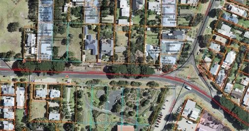
All of our live property parcels are now digitised.
1
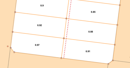
Victoria is the first state in Australia to take a state-wide integrated approach to improving property boundaries.
8
The number of Vicmap products we are improving to make sure we have true data and more accurate boundaries across Victoria.
3,790,000
The number of spatially adjusted parcels that have been integrated to Vicmap by 8 April 2024.
Why are we investing to upgrade the digital cadastre?
Upgrading the digital cadastre will reduce financial costs and boost productivity for government, the private sector and everyone involved in the planning stage of large infrastructure projects.