
On this page:
Standard Grid System
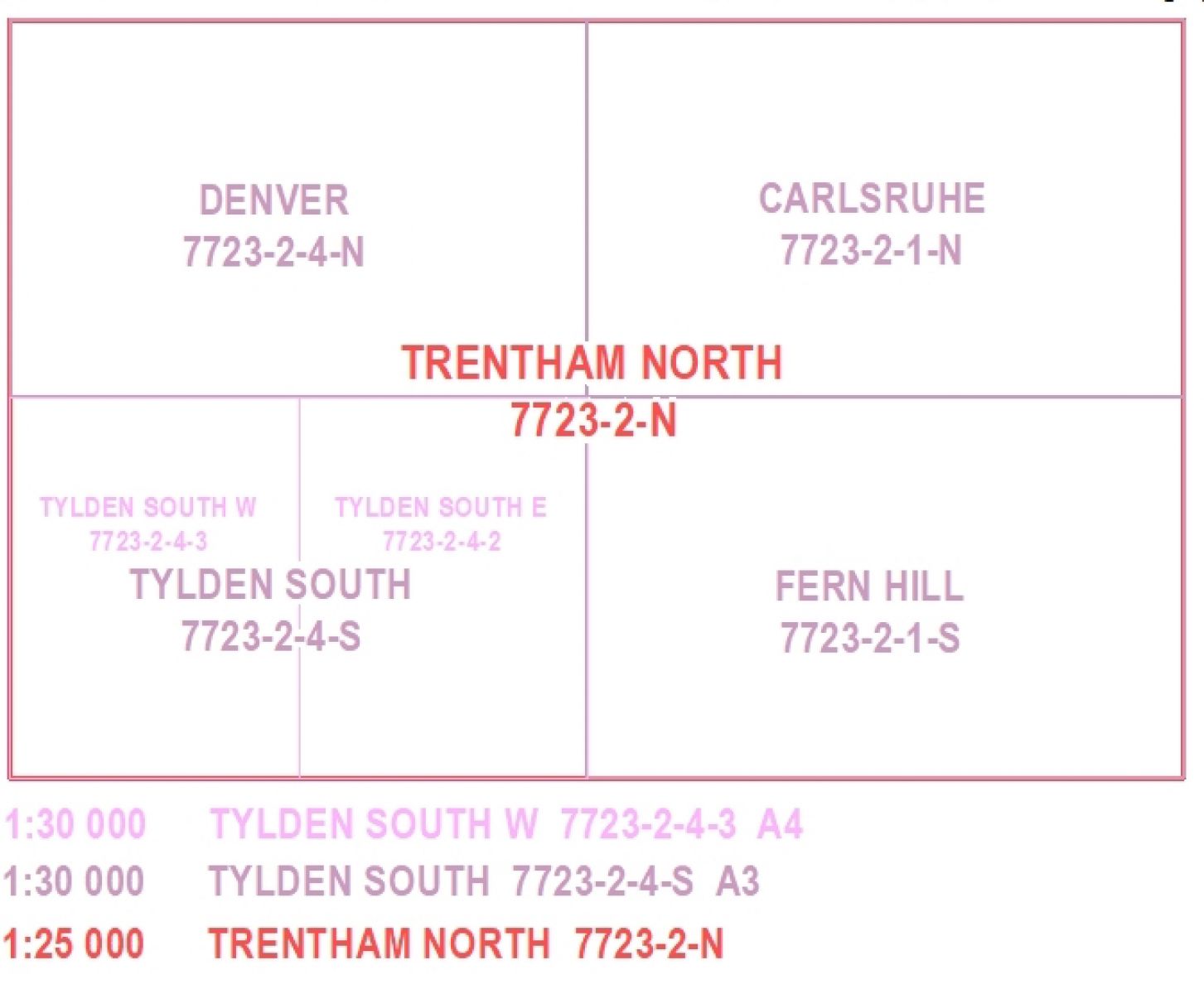
Vicmap Topographic Mapping 1:25 000, 1:30 000, 1:50 000 and 1:100 000 mapsheets are all interlinked spatially and by a numbering convention.
The links between the various scales are shown for 1:35 000, 1:50 000 and 1:100 000 mapping:
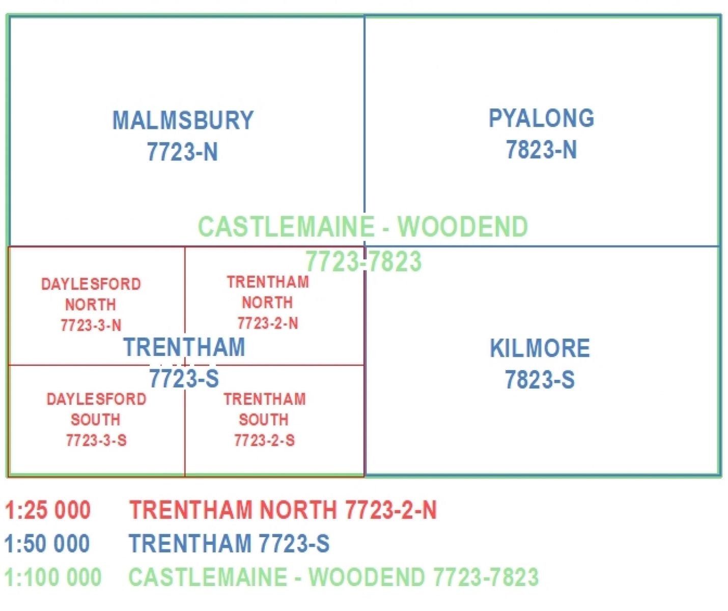
The links between the various scales are shown for 1:25 000, 1:50 000 and 1:100 000 mapping:
Magnetic Information
All mapsheets are created using MGA (Map Grid of Australia) coordinates and are aligned to Grid North for the relevant zone.
- Zone 54 is longitude 138° to 144°
- and zone 55 is longitude 144° to 150°
To convert a bearing calculated from the map to a magnetic bearing (as shown on a compass) requires a correction for the magnetic declination.
Each map shows the value of Grid Convergence and Magnetic Declination calculated for the centre of the map.
Read more on map products:
Page last updated: 11/07/23